
Gallatin County, Illinois
Gallatin County | |
|---|---|
 Gallatin County Courthouse in Shawneetown | |
 Location within the U.S. state of Illinois | |
 Illinois's location within the U.S. | |
| Coordinates: 37°46′N 88°14′W / 37.76°N 88.23°W | |
| Country | |
| State | |
| Founded | 1812 |
| Named for | Albert Gallatin |
| Seat | Shawneetown |
| Largest city | Shawneetown |
| Area | |
| • Total | 328 sq mi (850 km2) |
| • Land | 323 sq mi (840 km2) |
| • Water | 5.1 sq mi (13 km2) 1.6% |
| Population (2020) | |
| • Total | 4,946 |
| • Density | 15/sq mi (6/km2) |
| Time zone | UTC−6 (Central) |
| • Summer (DST) | UTC−5 (CDT) |
| Congressional district | 12th |
Gallatin County is a county located in the U.S. state of Illinois. According to the 2020 census, it has a population of 4,946, making it the third-least populous county in Illinois. Its county seat is Shawneetown.[1] It is located in the southern portion of Illinois known locally as Little Egypt. Located at the mouth of the Wabash River, Gallatin County, along with neighboring Posey County, Indiana, and Union County, Kentucky form the tri-point of the Illinois-Indiana-Kentucky Tri-State Area.
History[edit]
Salt production served as the state's first major industry in the early 19th century. Saltworks developed first by Native Americans, and the French had settled at the Great Salt Spring on the south side of the Saline River, about five miles downstream from Equality. Beginning in 1803, salt works were also developed at Half Moon Lick, southwest of Equality on the north side of the Saline River. Half Moon Lick is now on private land, but the Great Salt Springs are on public lands in the Shawnee National Forest, about one mile west of the Saline River bridge across Illinois Route 1 on Salt Well Road.[2]
Gallatin County was organized in 1812 from land formerly in Randolph County. It was named for Albert Gallatin,[3] who was then Secretary of the Treasury. The bank at Shawneetown was the first in Illinois. It was originally in the John Marshall House, which has been rebuilt and serves as the museum of the Gallatin County Historical Society. This should not be confused with the State Bank of Illinois building, which is a state historic site a block away in Old Shawneetown
-
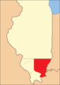 Gallatin County created in the Illinois Territory period between 1812 and 1815
 -
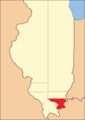 Gallatin between 1815 and 1816
 -
![Gallatin between 1816 and 1818, including unorganized territory (formerly part of Johnson County) temporarily attached to it.[4]](//upload.wikimedia.org/wikipedia/commons/thumb/3/38/Gallatin_County_Illinois_1816.png/85px-Gallatin_County_Illinois_1816.png) Gallatin between 1816 and 1818, including unorganized territory (formerly part of Johnson County) temporarily attached to it.[4]
Gallatin between 1816 and 1818, including unorganized territory (formerly part of Johnson County) temporarily attached to it.[4] -
 Gallatin between 1818 and 1847
 -
 Gallatin in 1847, when a cession to Hardin and the creation of Saline County reduced it to its current territory


![Gallatin between 1816 and 1818, including unorganized territory (formerly part of Johnson County) temporarily attached to it.[4]](/wiki/File:Gallatin_County_Illinois_1816.png)


Geography[edit]
According to the U.S. Census Bureau, the county has a total area of 328 square miles (850 km2), of which 323 square miles (840 km2) is land and 5.1 square miles (13 km2) (1.6%) is water.[5]
The Wabash and Ohio rivers join in the northeastern part of the county. The Saline River is a major drainage in the county, and it feeds into the Ohio River.
Climate and weather[edit]
| Shawneetown, Illinois | ||||||||||||||||||||||||||||||||||||||||||||||||||||||||||||
|---|---|---|---|---|---|---|---|---|---|---|---|---|---|---|---|---|---|---|---|---|---|---|---|---|---|---|---|---|---|---|---|---|---|---|---|---|---|---|---|---|---|---|---|---|---|---|---|---|---|---|---|---|---|---|---|---|---|---|---|---|
| Climate chart (explanation) | ||||||||||||||||||||||||||||||||||||||||||||||||||||||||||||
| ||||||||||||||||||||||||||||||||||||||||||||||||||||||||||||
| ||||||||||||||||||||||||||||||||||||||||||||||||||||||||||||
In recent years, average temperatures in the county seat of Shawneetown have ranged from a low of 21 °F (−6 °C) in January to a high of 87 °F (31 °C) in July, although a record low of −22 °F (−30 °C) was recorded in January 1994 and a record high of 104 °F (40 °C) was recorded in August 2007. Average monthly precipitation ranged from 3.22 inches (82 mm) in October to 5.02 inches (128 mm) in May.[6]
Transit[edit]
Major highways[edit]
Adjacent counties[edit]
- White County - north
- Posey County, Indiana - northeast
- Union County, Kentucky - east
- Hardin County - south
- Saline County - west
- Hamilton County - northwest
National protected area[edit]
- Shawnee National Forest (part)
Demographics[edit]
| Census | Pop. | Note | %± |
|---|---|---|---|
| 1820 | 3,155 | — | |
| 1830 | 7,405 | 134.7% | |
| 1840 | 10,760 | 45.3% | |
| 1850 | 5,448 | −49.4% | |
| 1860 | 8,055 | 47.9% | |
| 1870 | 11,134 | 38.2% | |
| 1880 | 12,861 | 15.5% | |
| 1890 | 14,935 | 16.1% | |
| 1900 | 15,836 | 6.0% | |
| 1910 | 14,628 | −7.6% | |
| 1920 | 12,856 | −12.1% | |
| 1930 | 10,091 | −21.5% | |
| 1940 | 11,414 | 13.1% | |
| 1950 | 9,818 | −14.0% | |
| 1960 | 7,638 | −22.2% | |
| 1970 | 7,418 | −2.9% | |
| 1980 | 7,590 | 2.3% | |
| 1990 | 6,909 | −9.0% | |
| 2000 | 6,445 | −6.7% | |
| 2010 | 5,589 | −13.3% | |
| 2020 | 4,946 | −11.5% | |
| 2023 (est.) | 4,670 | [7] | −5.6% |
| U.S. Decennial Census[8] 1790-1960[9] 1900-1990[10] 1990-2000[11] 2010-2017[12] | |||

2020[edit]
As of the 2020 census, there were 4,946 people, 2,155 households, and 3,764 families residing in the county[13] The racial makeup of the county was 95.03% white, 0.102% American Indian, 0.526% black or African American, 0.486% Asian, 0.445% from other races, and 3.013% from two or more races. Those of Hispanic or Latino origin made up 1.072% of the population. In terms of ancestry, 18.1% were German, 13.6% were Irish, 14% were English.[14]
The median income for a household in the county was $51,868 and the median income for a family was $65,833. [15]
Communities[edit]
City[edit]
Villages[edit]
Unincorporated communities[edit]
Townships[edit]
See also[edit]
References[edit]
- ^ "Find a County". National Association of Counties. Archived from the original on May 31, 2011. Retrieved June 7, 2011.
- ^ Jon Musgrave. 2004, Rev. ed. 2005. Slaves, Salt, Sex & Mr. Crenshaw: The Real Story of the Old Slave House and America's Reverse Underground Railroad. Marion, Ill.: IllinoisHistory.com. 57-65.
- ^ Gannett, Henry (1905). The Origin of Certain Place Names in the United States. Govt. Print. Off. pp. 133.
- ^ White, Jesse. Origin and Evolution of Illinois Counties. State of Illinois, March 2010. [1]
- ^ "Population, Housing Units, Area, and Density: 2010 - County". United States Census Bureau. Archived from the original on February 12, 2020. Retrieved July 11, 2015.
- ^ a b "Monthly Averages for Shawneetown, Illinois". The Weather Channel. Retrieved January 27, 2011.
- ^ "Annual Estimates of the Resident Population for Counties: April 1, 2020 to July 1, 2023". United States Census Bureau. Retrieved April 2, 2024.
- ^ "U.S. Decennial Census". United States Census Bureau. Retrieved July 5, 2014.
- ^ "Historical Census Browser". University of Virginia Library. Retrieved July 5, 2014.
- ^ "Population of Counties by Decennial Census: 1900 to 1990". United States Census Bureau. Retrieved July 5, 2014.
- ^ "Census 2000 PHC-T-4. Ranking Tables for Counties: 1990 and 2000" (PDF). United States Census Bureau. Archived (PDF) from the original on March 27, 2010. Retrieved July 5, 2014.
- ^ "State & County QuickFacts". United States Census Bureau. Archived from the original on June 6, 2011. Retrieved July 5, 2014.
- ^ "Gallatin County, Illinois".
- ^ "Gallatin County Census".
- ^ "Gallatin County, Il Census".
Further reading[edit]
- 1887. History of Gallatin, Saline, Hamilton, Franklin and Williamson Counties, Illinois. Chicago: Goodspeed Publishing Co.
- Musgrave, Jon, ed. 2002. Handbook of Old Gallatin County and Southeastern Illinois. Marion, Ill.: IllinoisHistory.com. 464 pages.
- Musgrave, Jon. 2004, Rev. ed. 2005. Slaves, Salt, Sex & Mr. Crenshaw: The Real Story of the Old Slave House and America's Reverse Underground R.R.. Marion, Ill.: IllinoisHistory.com. 608 pages.
- Waggoner, Horace Q., interviewer. 1978. "Lucille Lawler Memoir" Shawneetown Bank Project. Sangamon State University. Springfield, Ill.
External links[edit]
- History of Gallatin County http://www.rootsweb.com/~ilgallat/gch.htm
- History of Gallatin County and its Communities https://web.archive.org/web/20060413162609/http://www.lth6.k12.il.us/schools/gallatin/communities.htm
Places adjacent to Gallatin County, Illinois | ||||||||||||||||
|---|---|---|---|---|---|---|---|---|---|---|---|---|---|---|---|---|
| ||||||||||||||||
Municipalities and communities of Gallatin County, Illinois, United States | ||
|---|---|---|
| City |  | |
| Villages | ||
| Townships | ||
| Unincorporated communities | ||
| Counties |  | |
|---|---|---|
| Mid-sized cities (25,000+) | ||
| Small cities (10,000-25,000) | ||
| Small cities (5,000-10,000) | ||
| Transit systems | ||
| Amtrak stations | ||
| Interstates | ||
| Airports/military bases |
| |
| Universities | ||
| Colleges | ||
| Sports teams based in Southern Illinois | ||
| International | |
|---|---|
| National | |
| Other | |