
Brook Highland, Alabama
Brook Highland, Alabama | |
|---|---|
 Location of Brook Highland in Shelby County, Alabama. | |
| Coordinates: 33°25′42″N 86°41′34″W / 33.42833°N 86.69278°W | |
| Country | United States |
| State | Alabama |
| County | Shelby |
| Area | |
| • Total | 2.85 sq mi (7.38 km2) |
| • Land | 2.78 sq mi (7.21 km2) |
| • Water | 0.06 sq mi (0.17 km2) |
| Elevation | 663 ft (202 m) |
| Population (2020) | |
| • Total | 7,406 |
| • Density | 2,660.20/sq mi (1,027.07/km2) |
| Time zone | UTC-6 (Central (CST)) |
| • Summer (DST) | UTC-5 (CDT) |
| ZIP code | 35242[2] |
| Area code(s) | 205 and 659 |
| FIPS code | 01-40806 |
| GNIS feature ID | 154317[3] |
Brook Highland (formerly known as Lake Purdy) is an unincorporated community and census-designated place in Shelby County, Alabama, United States.[3][4] At the 2020 census, the population was 7,406.
Geography[edit]
Brook Highland is located at 33°25′43″N 86°41′35″W / 33.42861°N 86.69306°W (33.428571, -86.693028).[5]
The community is located southeast of Birmingham along U.S. Route 280. Many shopping centers, restaurants, and neighborhoods are located in the community adjacent to U.S. 280. Downtown Birmingham is 13 mi (21 km) to the northwest, and Chelsea is 8 mi (13 km) southeast, both via U.S. 280.
According to the U.S. Census Bureau, the community has a total area of 2.9 square miles (7.5 km2), of which 2.8 square miles (7.3 km2) is land and 0.05 square miles (0.13 km2) (1.87%) is water.
Demographics[edit]
| Census | Pop. | Note | %± |
|---|---|---|---|
| 1990 | 1,840 | — | |
| 2000 | 5,799 | 215.2% | |
| 2010 | 6,746 | 16.3% | |
| 2020 | 7,406 | 9.8% | |
| source:[6] | |||
As of the census[7] of 2000, there were 5,799 people, 2,789 households, and 1,327 families living in the community. The population density was 1,936.7 inhabitants per square mile (747.8/km2). There were 3,044 housing units at an average density of 1,016.6 per square mile (392.5/km2). The racial makeup of the community was 86.62% White, 7.78% Black or African American, 0.38% Native American, 4.14% Asian, 0.02% Pacific Islander, 0.47% from other races, and 0.60% from two or more races. 3.43% of the population were Hispanic or Latino of any race.
There were 2,789 households, out of which 24.5% had children under the age of 18 living with them, 40.9% were married couples living together, 4.7% had a female householder with no husband present, and 52.4% were non-families. 42.0% of all households were made up of individuals, and 1.2% had someone living alone who was 65 years of age or older. The average household size was 2.08 and the average family size was 2.98.
In the community, the population was spread out, with 21.3% under the age of 18, 14.4% from 18 to 24, 43.8% from 25 to 44, 17.3% from 45 to 64, and 3.1% who were 65 years of age or older. The median age was 29 years. For every 100 females, there were 104.1 males. For every 100 females age 18 and over, there were 105.6 males.
The median income for a household in the community was $54,349, and the median income for a family was $91,989. Males had a median income of $49,792 versus $32,188 for females. The per capita income for the community was $39,019. About 0.2% of families and 3.5% of the population were below the poverty line, including 1.1% of those under age 18 and 1.7% of those age 65 or over.
2010 census[edit]
As of the census[8] of 2010, there were 6,746 people, 3,242 households, and 1,588 families living in the community. The population density was 2,300 inhabitants per square mile (890/km2). There were 3,550 housing units at an average density of 1,267.9 per square mile (489.5/km2). The racial makeup of the community was 73.6% White, 16.2% Black or African American, 0.2% Native American, 4.4% Asian, 0% Pacific Islander, 3.5% from other races, and 2.1% from two or more races. 7.8% of the population were Hispanic or Latino of any race.
There were 3,242 households, out of which 23.1% had children under the age of 18 living with them, 37.9% were married couples living together, 8.3% had a female householder with no husband present, and 51.0% were non-families. 42.2% of all households were made up of individuals, and 2.2% had someone living alone who was 65 years of age or older. The average household size was 2.08 and the average family size was 2.93.
In the community, the population was spread out, with 20.3% under the age of 18, 13.5% from 18 to 24, 35.2% from 25 to 44, 25.6% from 45 to 64, and 5.4% who were 65 years of age or older. The median age was 31.3 years. For every 100 females, there were 98.2 males. For every 100 females age 18 and over, there were 95.9 males.
The median income for a household in the community was $57,214, and the median income for a family was $116,498. Males had a median income of $57,413 versus $41,948 for females. The per capita income for the community was $40,578. About 2.4% of families and 4.7% of the population were below the poverty line, including 2.3% of those under age 18 and 0% of those age 65 or over.
References[edit]
- ^ "2020 U.S. Gazetteer Files". United States Census Bureau. Retrieved October 29, 2021.
- ^ "Brook Highland ZIP Code". zipdatamaps.com. 2022. Retrieved January 12, 2023.
- ^ a b "Brook Highland". Geographic Names Information System. United States Geological Survey, United States Department of the Interior.
- ^ "Brook Highland Census Designated Place". Geographic Names Information System. United States Geological Survey, United States Department of the Interior.
- ^ "US Gazetteer files: 2010, 2000, and 1990". United States Census Bureau. February 12, 2011. Retrieved April 23, 2011.
- ^ "CENSUS OF POPULATION AND HOUSING (1790-2000)". U.S. Census Bureau. Retrieved August 8, 2010.
- ^ "U.S. Census website". United States Census Bureau. Retrieved January 31, 2008.
- ^ "U.S. Census website". United States Census Bureau. Retrieved August 8, 2015.
33°25′43″N 86°41′35″W / 33.428571°N 86.693028°W
Municipalities and communities of Shelby County, Alabama, United States | ||
|---|---|---|
| Cities | 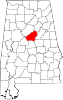 | |
| Towns | ||
| CDPs | ||
| Other unincorporated communities | ||
| Footnotes | ‡This populated place also has portions in an adjacent county or counties | |