
Central City, Arkansas
Central City, Arkansas | |
|---|---|
 Location of Central City in Sebastian County, Arkansas. | |
| Coordinates: 35°19′36″N 94°14′25″W / 35.32667°N 94.24028°W | |
| Country | United States |
| State | Arkansas |
| County | Sebastian |
| Area | |
| • Total | 2.28 sq mi (5.92 km2) |
| • Land | 2.22 sq mi (5.76 km2) |
| • Water | 0.06 sq mi (0.16 km2) |
| Elevation | 440 ft (134 m) |
| Population (2020) | |
| • Total | 461 |
| • Density | 207.28/sq mi (80.03/km2) |
| Time zone | UTC-6 (Central (CST)) |
| • Summer (DST) | UTC-5 (CDT) |
| ZIP code | 72941 |
| Area code | 479 |
| FIPS code | 05-13120 |
| GNIS feature ID | 0076575 |
Central City is a city[2] in Sebastian County, Arkansas, United States. It is part of the Fort Smith, Arkansas-Oklahoma Metropolitan Statistical Area. At the 2010 Census, the population of Central City was 502. According to the 2018 US Census Bureau estimates, Central City had a population of 497.[3]
Geography[edit]
Central City is located at 35°19′36″N 94°14′25″W / 35.32667°N 94.24028°W (35.326587, -94.240225).[4]
According to the United States Census Bureau, the town has a total area of 5.6 km2 (2.2 mi2), all land.
Demographics[edit]
| Census | Pop. | Note | %± |
|---|---|---|---|
| 1980 | 339 | — | |
| 1990 | 419 | 23.6% | |
| 2000 | 531 | 26.7% | |
| 2010 | 502 | −5.5% | |
| 2020 | 461 | −8.2% | |
| U.S. Decennial Census[5] 2018 Estimate[6] | |||
As of the census[7] of 2000, there were 531 people, 216 households, and 166 families residing in the town. The population density was 94.5/km2 (245.1/mi2). There were 227 housing units at an average density of 40.4/km2 (104.8/mi2). The racial makeup of the town was 96.23% White, 1.51% Black or African American, 0.94% from other races, and 1.32% from two or more races. 1.69% of the population were Hispanic or Latino of any race.
There were 216 households, out of which 26.4% had children under the age of 18 living with them, 66.2% were married couples living together, 8.8% had a female householder with no husband present, and 23.1% were non-families. 21.8% of all households were made up of individuals, and 7.4% had someone living alone who was 65 years of age or older. The average household size was 2.42 and the average family size was 2.81.
In the town, the population was spread out, with 20.3% under the age of 18, 7.2% from 18 to 24, 27.3% from 25 to 44, 31.3% from 45 to 64, and 13.9% who were 65 years of age or older. The median age was 41 years. For every 100 females, there were 93.8 males. For every 100 females age 18 and over, there were 91.4 males.
The median income for a household in the town was $38,173, and the median income for a family was $43,958. Males had a median income of $31,964 versus $20,875 for females. The per capita income for the town was $15,892. About 7.8% of families and 15.8% of the population were below the poverty line, including 20.3% of those under age 18 and 7.9% of those age 65 or over.
Education[edit]
Lavaca School District is an accredited public school district that encompasses 58.77 square miles (152.2 km2) of land[citation needed] including Lavaca and Central City,[8] and provides early childhood, elementary and secondary education to students leading to graduation from Lavaca High School.
References[edit]
- ^ "2020 U.S. Gazetteer Files". United States Census Bureau. Retrieved October 29, 2021.
- ^ Local.Arkansas.gov - Central City, retrieved September 3, 2012
- ^ "Population and Housing Unit Estimates". Retrieved March 17, 2020.
- ^ "US Gazetteer files: 2010, 2000, and 1990". United States Census Bureau. February 12, 2011. Retrieved April 23, 2011.
- ^ "Census of Population and Housing". Census.gov. Retrieved June 4, 2015.
- ^ "Population Estimates". United States Census Bureau. Retrieved June 8, 2018.
- ^ "U.S. Census website". United States Census Bureau. Retrieved January 31, 2008.
- ^ "2020 CENSUS - SCHOOL DISTRICT REFERENCE MAP: Sebastian County, AR" (PDF). U.S. Census Bureau. Retrieved September 19, 2022.
Municipalities and communities of Sebastian County, Arkansas, United States | ||
|---|---|---|
| Cities | 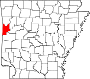 | |
| Towns | ||
| Unincorporated communities | ||
| Footnotes | ‡This populated place also has portions in an adjacent county or counties | |