
Alberta Highway 2A
Highway 2A | ||||
|---|---|---|---|---|
 Segments of Highway 2A in Alberta | ||||
| Route information | ||||
| Auxiliary route of Hwy 2 | ||||
| Maintained by Alberta Ministry of Transportation | ||||
| Southern Alberta segment | ||||
| Length | 46 km[1] (29 mi) | |||
| South end | ||||
| Major intersections | ||||
| North end | ||||
| Central Alberta segment | ||||
| Length | 229 km[1] (142 mi) | |||
| South end | ||||
| Major intersections | ||||
| North end | ||||
| Northern Alberta segments | ||||
| Length | 53 km[1] (33 mi) Sexsmith 15 km (9 mi) High Prairie 27 km (17 mi) Grimshaw 11 km (7 mi) | |||
| Location | ||||
| Country | Canada | |||
| Province | Alberta | |||
| Specialized and rural municipalities | Foothills County, Rocky View County, Mountain View County, Red Deer County, Lacombe County, Ponoka County, Wetaskiwin No. 10 County, Leduc County, Lesser Slave River No. 124 M.D., Big Lakes County, Smoky River No. 130 M.D., Peace No. 135 M.D. | |||
| Major cities | Calgary, Red Deer, Lacombe, Wetaskiwin, Leduc | |||
| Towns | High River, Okotoks, Crossfield, Carstairs, Olds, Bowden, Innisfail, Penhold, Blackfalds, Ponoka, Millet, Grimshaw | |||
| Highway system | ||||
|
| ||||
| ||||

Alberta Provincial Highway No. 2A[2] is the designation of six alternate routes off Highway 2 in Alberta, Canada. In general, these are original sections of Highway 2, such as the southern portion of Macleod Trail in Calgary. They passed through communities before limited-access freeways were built to shorten driving distance, accommodate heavier volumes and to bypass city traffic. Portions of the alignment of Highway 2A follow the route of the former Calgary and Edmonton Trail.
High River – Calgary[edit]
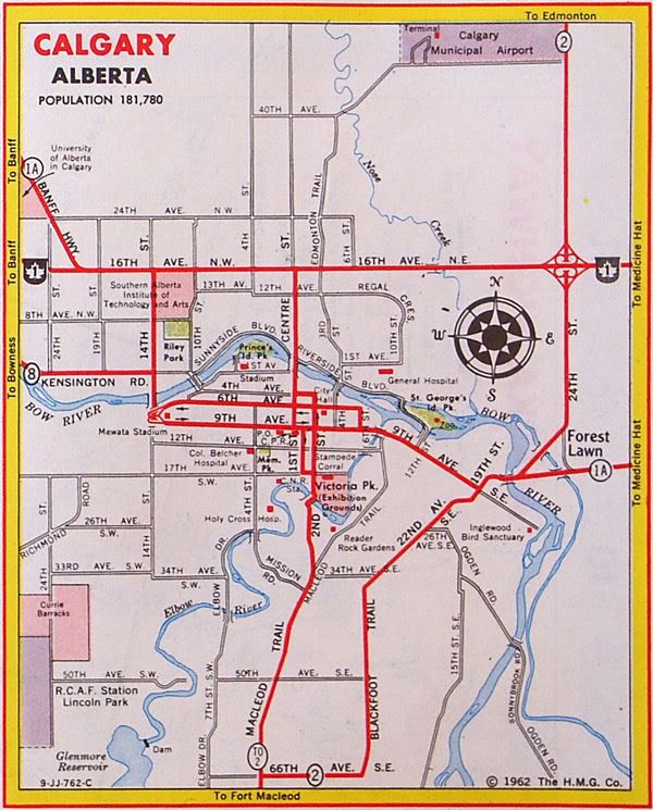
Highway 2A currently begins in the Town of High River and follows 12 Avenue SE and Centre Street before passing by Aldersyde and intersecting Highway 7. The highway then travels westward to the Town of Okotoks, where it branches north and follows Southridge Drive and Northridge Drive through Okotoks before rejoining Highway 2 near De Winton. In 2003, it was extended north by sharing a common alignment with Highway 2 for 3 km (2 mi) until it splits to Deerfoot Trail (Highway 2) Macleod Trail (Highway 2A) and ends in the City of Calgary at Stoney Trail (Highway 201). Macleod Trail continues north into downtown Calgary but does not carry a highway designation.[3]

Major intersections[edit]
| Rural/specialized municipality | Location | km[1] | mi | Destinations | Notes |
|---|---|---|---|---|---|
| Foothills County | High River | −1.6 | −0.99 | Continues east | |
| Interchange (exit 194 on Hwy 2) | |||||
| 0.0 | 0.0 | 10 Street SE | Becomes Hwy 23; former Hwy 2A south | ||
| 1.5 | 0.93 | Centre Street / 12 Avenue SE | Roundabout; Hwy 2A branches north | ||
| 2.8 | 1.7 | Crosses the Highwood River | |||
| 5.1 | 3.2 | ||||
| Aldersyde | 15.8 | 9.8 | South end of Hwy 7 concurrency; Hwy 2A turns west; exit 209 on Hwy 2 | ||
| Okotoks | 20.1 | 12.5 | 32 Street E | ||
| 21.8 | 13.5 | Hwy 2A branches north; north end of Hwy 7 concurrency | |||
| 24.1 | 15.0 | Crosses the Sheep River (North end of Southridge Drive • South end of Northridge Drive) | |||
| 24.6 | 15.3 | ||||
| | 32.0 | 19.9 | 290 Avenue E – De Winton | ||
| 33.0 | 20.5 | Interchange (exit 222 on Hwy 2); Hwy 2A branches northwest; south end of Hwy 2 concurrency | |||
| 35.6 | 22.1 | Partial Interchange (exit 225 on Hwy 2); northbound exit, southbound entrance; north end of Hwy 2 concurrency | |||
| 38.4 | 23.9 | Dunbow Road – De Winton, Heritage Pointe | Northbound access to Hwy 552 | ||
| ↑ / ↓ | | 40.4 | 25.1 | Southbound right in/right out | |
| City of Calgary | 42.6 | 26.5 | 210 Avenue S – Calgary | ||
| 43.7 | 27.2 | 194 Avenue S – Calgary | |||
| 45.7 | 28.4 | ||||
| Macleod Trail – City Centre | Continues north | ||||
1.000 mi = 1.609 km; 1.000 km = 0.621 mi
| |||||
Central Alberta[edit]


Highway 2A runs adjacent to the Queen Elizabeth II Highway between Calgary and Edmonton, although it does not enter either city. Highway 2A generally runs parallel to the Canadian Pacific Railway Calgary-Edmonton line, which runs to the west of Highway 2 between Crossfield and Red Deer, and to the east of Highway 2 between Red Deer and Leduc. Highway 2A is divided into two subsections with a 13 km (8 mi) gap between Bowden and Innisfail.[4]
The first subsection of Highway 2A starts at the Highway 2 / Highway 72 interchange (Exit 295) and passes through the town of Crossfield, town of Carstairs, and by the town of Didsbury before entering the town of Olds along 46 Avenue and intersects Highway 27 (46 Street). The highway continues north to the town of Bowden before terminating at Highway 587, just west of Highway 2 (Exit 357).[1]
The second subsection begins in the town of Innisfail at Highway 590 (50 Street), just west of Highway 2 (Exit 368), along 42 Avenue. The highway continues north and passes through the town of Penhold before entering the city of Red Deer along Taylor Drive. The highway turns east along 19 Street and then north along Gaetz Avenue. Highway 2A splits into one-way couplets through downtown Red Deer, with northbound traffic following 49 Avenue and southbound traffic following portions of Gaetz Avenue and 51 Avenue. After crossing the Red Deer River, the one-way streets rejoin and intersect Highway 11 (67 Street) and Highway 11A, which forms Red Deer's northern city limit. The highway continues north through the town of Blackfalds and city of Lacombe. North of Lacombe, the highway rejoins Highway 2 and share the same alignment for 5 km (3 mi) before the highway branches northeast and passes through hamlet of Morningside, town of Ponoka, and hamlet of Maskwacis. The highway enters the city of Wetaskiwin along 56 Street and continues north through the town of Millet, by the hamlet of Kavanagh, and before it rejoins Highway 2 (Exit 516) in the city of Leduc.
Major intersections[edit]
| Rural/specialized municipality | Location | km[1] | mi | Destinations | Notes | |||
|---|---|---|---|---|---|---|---|---|
| Rocky View County | | 0.0 | 0.0 | Interchange; Hwy 2 exit 295; continues as Hwy 72 | ||||
| 2.1 | 1.3 | Dickson Stevenson Trail – Airdrie | ||||||
| Crossfield | 6.4 | 4.0 | ||||||
| | 11.3 | 7.0 | Hwy 2 exit 305 | |||||
| Mountain View County | | 18.9 | 11.7 | |||||
| Carstairs | 22.4 | 13.9 | ||||||
| Didsbury | 33.8 | 21.0 | ||||||
| Olds | 48.3 | 30.0 | ||||||
| Red Deer County | | 62.2 | 38.6 | Access from southbound Hwy 2 only (exit 353) | ||||
| Bowden | 66.4 | 41.3 | Adjacent to Hwy 2 / Hwy 587 interchange (Hwy 2 exit 357) | |||||
| 13 km (8 mi) gap in Hwy 2A | ||||||||
| Red Deer County | Innisfail | 79.0 | 49.1 | Former Hwy 54; adjacent to Hwy 2 / Hwy 590 interchange (exit 368 on Hwy 2) | ||||
| Penhold | 92.7 | 57.6 | ||||||
| Springbrook | 96.0 | 59.7 | ||||||
| | 99.5 | 61.8 | McKenzie Road (Township Road 374) | |||||
| 102.9 | 63.9 | Hwy 2 exit 394 | ||||||
| City of Red Deer | 103.6 | 64.4 | Hwy 2 exit 395; Hwy 2A follows 19 Street | |||||
| 104.1 | 64.7 | Hwy 2A follows Gaetz Avenue | ||||||
| 106.1 | 65.9 | 32 Street | ||||||
| 109.1 | 67.8 | Crosses the Red Deer River | ||||||
| 110.4 | 68.6 | |||||||
| 113.6 | 70.6 | |||||||
| Red Deer County |
No major junctions | |||||||
| ↑ / ↓ | | 118.7 | 73.8 | Crosses the Blindman River | ||||
| Lacombe County | Blackfalds | 120.0 | 74.6 | Roundabout | ||||
| City of Lacombe | 132.3 | 82.2 | ||||||
| Lacombe County | | 138.4 | 86.0 | Interchange; Hwy 2 exit 431; south end of Hwy 2 concurrency | ||||
| 144.0 | 89.5 | Interchange; Hwy 2 exit 437; north end of Hwy 2 concurrency | ||||||
| Morningside | 146.9 | 91.3 | ||||||
| Ponoka County | | 156.4 | 97.2 | Crosses the Battle River | ||||
| Ponoka | 158.2 | 98.3 | ||||||
| Samson I.R. No. 137 | Maskwacis | 177.3 | 110.2 | South end of Hwy 611 concurrency | ||||
| Ermineskin I.R. No. 138 | 180.1 | 111.9 | North end of Hwy 611 concurrency | |||||
| County of Wetaskiwin No. 10 |
No major junctions | |||||||
| City of Wetaskiwin | 193.5 | 120.2 | South end of Hwy 13 concurrency | |||||
| 196.7 | 122.2 | North end of Hwy 13 concurrency | ||||||
| County of Wetaskiwin No. 10 | Millet | 209.5 | 130.2 | South end of Hwy 616 concurrency | ||||
| Leduc County | | 214.5 | 133.3 | North end of Hwy 611 concurrency | ||||
| Kavanagh | 221.3 | 137.5 | Glen Park Road (Township Road 490) | |||||
| City of Leduc | 227.2 | 141.2 | Southfork Drive / 50 Street | |||||
| 229.0 | 142.3 | Interchange; Hwy 2; exit 516 | ||||||
1.000 mi = 1.609 km; 1.000 km = 0.621 mi
| ||||||||
Smith[edit]
| Highway 2A | |
| Length: | 15 km (9 mi)[1] |
| South end: | |
| North end: | Smith |
Highway 2A, known as Highway 2A:44 by Alberta Transportation, begins Highway 2 near the hamlet of Hondo and connects with hamlet of Smith.[3]
Major intersections[edit]
| Rural/specialized municipality | Location | km[1] | mi | Destinations | Notes |
|---|---|---|---|---|---|
| M.D. of Lesser Slave River No. 124 | | 0.0 | 0.0 | Southern terminus | |
| Hondo | 2.9 | 1.8 | Range Road 11A / Township Road 703A | ||
| Smith | 14.7 | 9.1 | 1 Avenue S | ||
| Old Smith Highway | Continues west | ||||
| 1.000 mi = 1.609 km; 1.000 km = 0.621 mi | |||||
High Prairie[edit]
| Highway 2A | |
| Length: | 27 km (17 mi)[1] |
| East end: | |
| West end: | |
Highway 2A, known as Highway 2A:54 by Alberta Transportation, begins at Highway 2 at the locality of Triangle, 15 km (9 mi) west of the Town of High Prairie, and connects with Highway 49 near the hamlet of Guy.[1] Prior to 1990, this section was signed as Highway 2 but was renumbered at the same time that Highway 34 was renumbered to Highway 43 (present day Highway 49) north of the Town of Valleyview.[5][6]
This segment of Highway 2A is considered an alternate route of the Northern Woods and Water Route.
Major intersections[edit]
| Rural/specialized municipality | Location | km[1] | mi | Destinations | Notes |
|---|---|---|---|---|---|
| Big Lakes County | | 0.0 | 0.0 | ||
| M.D. of Smoky River No. 130 | | 5.9 | 3.7 | Former Hwy 34 / Hwy 34A | |
| 27.4 | 17.0 | ||||
| 1.000 mi = 1.609 km; 1.000 km = 0.621 mi | |||||
Grimshaw[edit]
| Highway 2A | |
| Length: | 11 km (7 mi)[1] |
| East end: | |
| West end: | |
Highway 2A, known as Highway 2A:36 by Alberta Transportation, begins at Highway 2 at the locality of Roma Junction, 2 km (1 mi) west of the Peace River Airport and 13 km (8 mi) west of the town of Peace River, and terminates in the town of Grimshaw,[3] where it passes by Mile Zero monument of the Mackenzie Highway.
Major intersections[edit]
| Rural/specialized municipality | Location | km[1] | mi | Destinations | Notes |
|---|---|---|---|---|---|
| M.D. of Peace No. 135 | | 0.0 | 0.0 | ||
| Grimshaw | 11.4 | 7.1 | Mile Zero of Mackenzie Highway | ||
| 1.000 mi = 1.609 km; 1.000 km = 0.621 mi | |||||
Former alignments[edit]
Barlow Trail[edit]
Highway 2A | |
|---|---|
| Barlow Trail | |
| Location | Calgary |
| Length | 11 km (6.8 mi) |
| Existed | 1971–1980s |
In the 1960s, Highway 2 entered north Calgary along Barlow Trail; however in 1971 Highway 2 was realigned to the newly constructed Blackfoot Trail freeway (later renamed Deerfoot Trail).[7] Highway 2A was established along most of the original alignment, starting at 16 Avenue NE (Trans-Canada Highway, Highway 1) in the south and continuing north along Barlow Trail for 10 km (6.2 mi), past the Calgary International Airport, to 112 Avenue NE (later renamed Country Hills Boulevard), where it travelled west for 1 km (0.62 mi) to its interchange with Deerfoot Trail.[8] Direct access from Barlow Trail to Blackfoot Trail was closed to make room for the 17 Avenue SE / Blackfoot Trail / Deerfoot Trail interchange.[9]
The Highway 2A designation was phased out in the mid-1980s[10] and the Barlow Trail between 48 Avenue NE (just north of McKnight Boulevard) and the main terminal access was closed to allow for additional runway construction.[11]
High River – Cayley[edit]
Highway 2A | |
|---|---|
| Location | Foothills County |
| Length | 20 km[1] (12 mi) |
| Existed | 1950s–1997 |
The existing section of Highway 2A used extend from High River along 10 Street SE, through the hamlet of Cayley, and intersect Highway 2 at the locality of Connemara, located 8 km (5 mi) north of the town of Nanton along the Foothills County / Willow Creek M.D. boundary. The segment was located only 1.6 km (0.99 mi) west of Highway 2 and was lightly traveled, as such it was dropped by the province in 1997.[12][13]
See also[edit]
References[edit]
- ^ a b c d e f g h i j k l m n Google (December 3, 2017). "Highway 2A in Alberta" (Map). Google Maps. Google. Retrieved December 3, 2017.
- ^ Provincial Highways Designation Order, Alberta Transportation, p. 1
- ^ a b c "2015 Provincial Highways 1 - 216 Series Progress Chart" (PDF). Alberta Transportation. March 2015. Retrieved 2016-03-30.
- ^ Google (January 12, 2017). "Innisfail — Bowden gap on Highway 2A" (Map). Google Maps. Google. Retrieved January 12, 2017.
- ^ Alberta Official Road Map (Map). Travel Alberta. 1989. §§ F-3, G-3.
- ^ Alberta Official Road Map (Map). Travel Alberta. 1990. §§ F-3, G-3.
- ^ Klaszus, Jeremy (June 7, 2012). "Deerfoot's Revenge". Calgary Herald. Archived from the original on January 2, 2016. Retrieved October 20, 2016.
- ^ Alberta Official Road Map (Map). Travel Alberta. 1983. Calgary inset.
- ^ Alberta Official Road Map (Map). Government of the Province of Alberta. 1962. Calgary inset.
- ^ Alberta Official Road Map (Map). Travel Alberta. 1988. Calgary inset.
- ^ Markusoff, Jason (April 8, 2013). "Access road to Calgary's airport closing for four months". Calgary Herald. Archived from the original on April 11, 2013. Retrieved October 29, 2016.
- ^ Alberta Official Road Map (Map). Travel Alberta. 1996. § M-5.
- ^ Alberta Official Road Map (Map). Travel Alberta. 1997. § M-5.